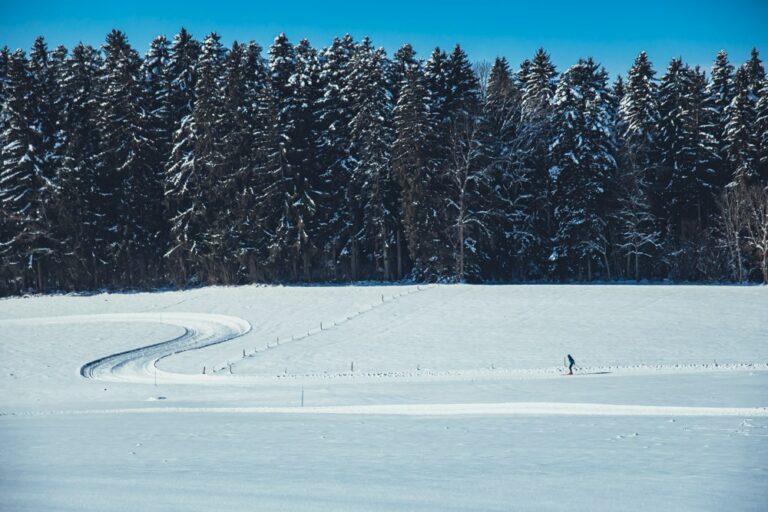
The topography of this place is ideal because of its slightly undulating pastures. The trail is four kilometers long and runs through pastures, surrounded by the peaks of the Dent de Lys and the Teysachaux.
The four kilometers of trail are prepared in the La Cuva area. With a departure at 1'230 meters of altitude, the snow cover is a major asset of this place since it often benefits from more abundant snowfalls.
Moreover, the setting is bucolic and enchanting with its surrounding forests, the panorama on the mountains of Teysachaux and the Dent de Lys, but also the heritage since the itinerary bypasses magnificent alpine chalets nestled under their white coat.
The entire route can be described as technical, but for the less athletic, it is possible to shorten the loop while enjoying the magnificent scenery.
The departure is located at the parking lot of La Cuva, only 6 km from the highway exit of Châtel-St-Denis.
Toilets are available and a covered area with benches and tables allows athletes to prepare or refuel under cover.
Information
ski-club Grattavache-Le Crêt
ski-club Grattavache-Le Crêt
1624 Grattavache
Paper passes on sale from :
Tourist Office - Châtel-St-Denis
Point Info - Les Paccots
Hôtel de la Croix-Fédérale - Le Crêt
Banque Cantonale de Fribourg - Le Crêt
Dupasquier Sports Cycles - Vuadens
Properties of the itinerarie
Type of activity: Sports
Difficulty: Very challenging
Distance: 4 km
Ascent/Descent: +121m / -121m
Altitude min./max.: 1232m / 1294m


