Region of Fribourg

The tourist region of Fribourg offers you unforgettable experiences... Lake, city or mountains, discover a real land of values!


Fribourg Meeting offers you the possibility to comfortably organize your future seminars or congresses.

Choose a region

La Gruyère
Fribourg/
Sarine
Estavayer-le-Lac
Region
Region
Murtensee
Schwarzsee -
Senseland
Romont Région
Les Paccots
- La Veveyse

What are you looking for?

Choose a region

Welcome to the website of Fribourg Region and its tourist regions. Please select on the map the region you wish to discover and browse through its offers. We wish you a lot of fun!

swiss map
La Gruyere
Fribourg
Estavayer-le-Lac
Region
Région Lac
de Morat
Schwarzsee-
Senseland
Romont
Les Paccots
You are in the region
Search

Trail Les Paccots – La Veveyse – marathon

Properties of the itinerarie

Type of activity: Sports

Difficulty: Very challenging

Distance: 42 km

Loop itinerary

Ascent/Descent: +2637m / -2637m

Altitude min./max.: 984m / 1963m

Trail Les Paccots - La Veveyse on 25 May 2025: Marathon course

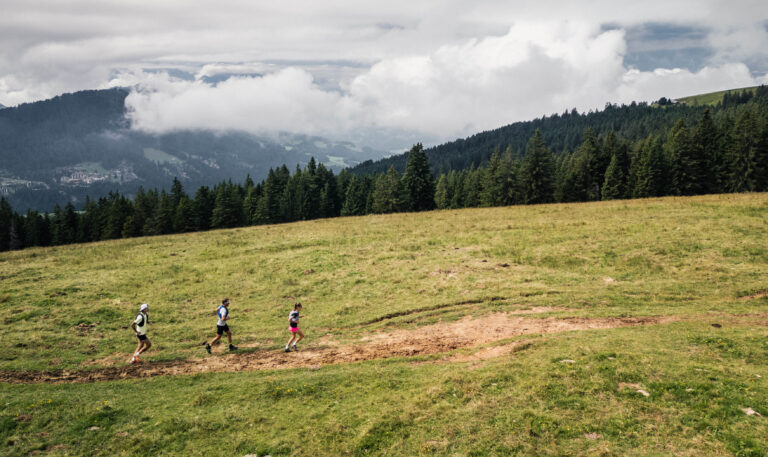
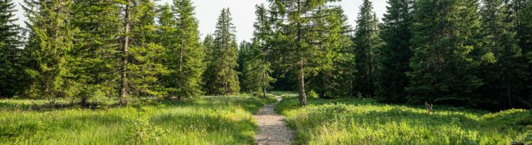
An extraordinary challenge for runners looking for an unforgettable experience! This mountain marathon will take you on a journey of discovery along spectacular ridges, alpine trails and breathtaking panoramas. With 2,637 metres of positive altitude difference, you'll have to manage your effort between demanding climbs and technical descents, while enjoying the wild and authentic scenery. An event where every stride is a total immersion in nature, for an unforgettable trail experience.

(Route subject to change)


Programme and further information on the event page.

Einzelne Tarife

Marathon registration 84.- CHF

Information

Les Paccots – La Veveyse Tourisme
Place d'Armes 15
1618 Châtel-St-Denis
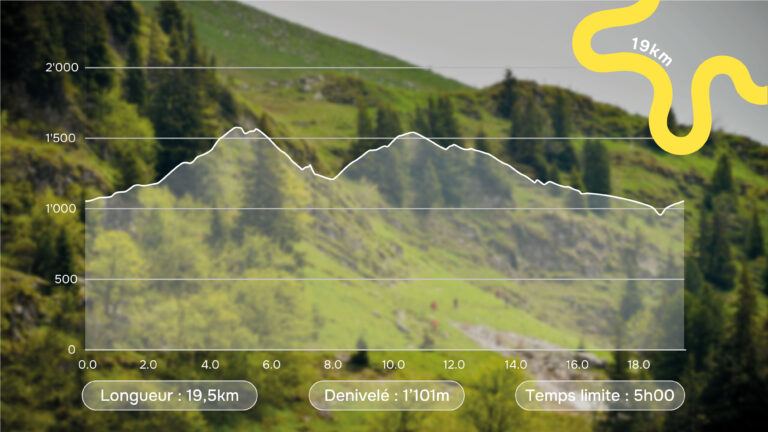
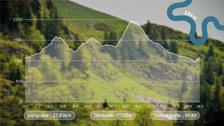
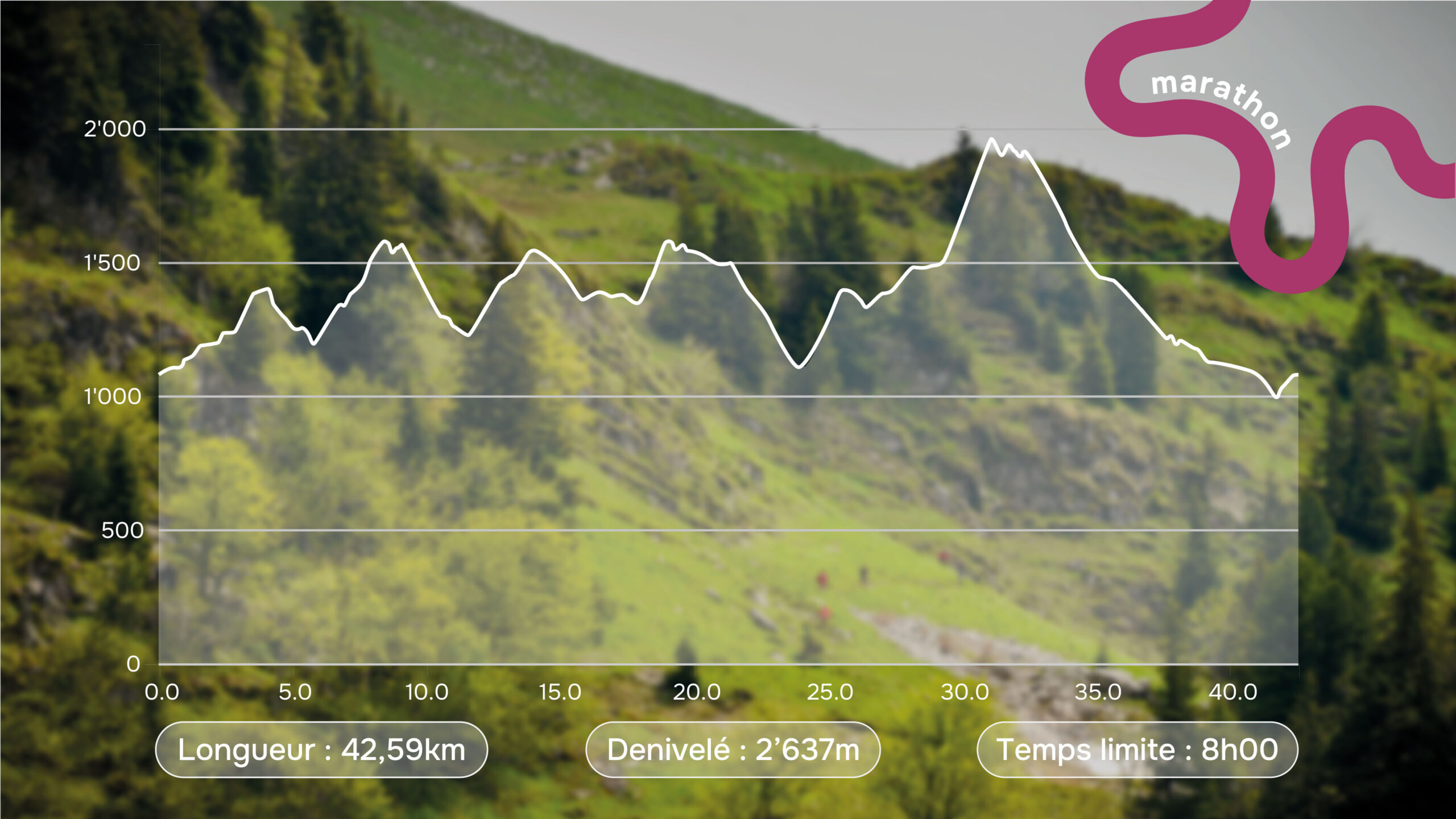
  • Distance: 42,59 km
  • Ascent: 2,637 m.
  • Time limit: 8.00 am
  • Race start: 7.30 am
  • Feed stations: kilometer 12, kilometer 25 and kilometer 35
    Timetable subject to change

Properties of the itinerarie

Type of activity: Sports

Difficulty: Very challenging

Distance: 42 km

Loop itinerary

Ascent/Descent: +2637m / -2637m

Altitude min./max.: 984m / 1963m

Download files

External links

Report an error

More information

We use cookies to enhance your experience on our website.

OK Preferences