Tour de la Molière – L’oeil de l’Helvétie
From the heights of the “Oculus Helvetiae” in the footsteps of the Romans
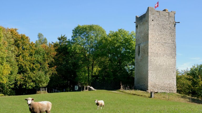
Setting off from the car park of the Vita exercise trail, we take the path descending alongside the tree cover and join the footpath. We cross the road and follow the stream on our right. Leaving the wood, we head left: the little rise alongside the quarry helps warm the calf muscles in readiness for what is to come. At the following junctions we keep to the path, bearing left. A second ascent warms the muscles before we continue bearing left and descending slightly while we catch our breath. We follow this path until we find ourselves apparently unable to continue at the edge of an open field. We cross the latter, carrying straight on to reach the copse, where we find our path and, at the next junction, join the waymarked footpath. Via a path by the name of Reine Berthe, we head towards the Tour de la Molière, also known as the Oeil de l’Helvétie or Eye of Helvetia. It can be visited (call 079 316 62 13 between 9 a.m. and 6 p.m. for the access code). It’s an ideal sheltered spot for a picnic. We then skirt the wood and, at the end of the path, fork left and go down a little steep path that leads to Franex. Franex Chapel comes with its own history: an interpretation panel 100m from the chapel reveals all. We continue heading towards Nuvilly until we reach Moulin (altitude point 547). We then take the footpath to our left before the Petite Glâne stream, which we follow as far as Granges-de-Vesin. We pass through the village, following the road for a few hundred metres before returning to the wood via the footpath on our right. We end our walk via the Vita trail and return to the car park.
Information
Estavayer-le-Lac Région, Place des Bastians 1, Estavayer-le-Lac
Place des Bastians 1
1470 Estavayer-le-Lac
Information
Association des Amis de la Tour de la Molière
-
1489 Murist
Properties of the itinerarie
Type of activity: Sports
Difficulty: Easy
Duration: 03:36
Distance: 12 km
Loop itinerary
Ascent/Descent: +485m / -485m
Altitude min./max.: 433m / 685m


