


Signalization in the canton of Fribourg
Routes
The green signs indicate directions to the highways.
The blue signs indicate directions to the main roads.
The white signs indicate directions to secondary roads.
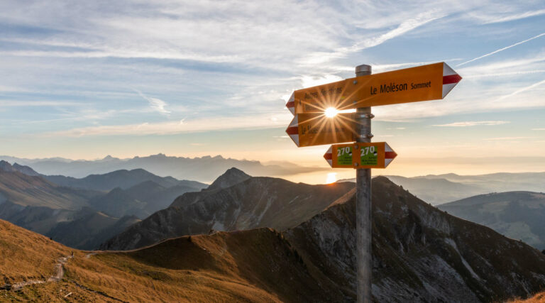
Hiking trails
The yellow signs inform about current position, hiking destination and walking time (breaks not included).
The yellow arrows indicate the path to take.
The yellow diamond confirm the way of the hiking trail.
Mountain trails
The yellow signs with the white-red-white point inform about current position, hiking destination and walking time (breaks not included).
The white-red-white arrows indicate the path to take.
The white-red-white strips confirm the way of the mountain trail.
SwitzerlandMobility
The signalization of SwitzerlandMobility routes is standard throughout Switzerland, based on Swiss norms for signalization of non-motorized traffic. This was revised for the realization of Switzerland-Mobility and is now the only international norm.
The system for denotation is uniform concerning names and numbers of the trails. One-digit numbers indicate national routes, two-digit numbers regional routes and three-digit numbers local routes.
Itinerary for hiking: Numbers on green background.
Itinerary for cycling: Numbers on blue background.
Itinerary for biking: Numbers on yellow background.
Itinerary for skating: Numbers on purple background.
Other signalisations
The tourist destinations are marked on brown signs (e.g. cultural sightseeing, leisure facilities, stops of public transport and accomodation).