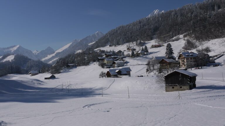
Running either side of the railway, with views over the hamlet of Allières and the mountain pastures of Le Revers, this is a pleasant route in the pure air, both by day and at night.
SwitzerlandMobility: route 275
Allières L’Ange–Allières L’Ange
From the La Croix-de-Fer hotel-restaurant, take the “barlatay” mule track that took cheese from La Gruyère to Lyon in the last century.
Follow in their footsteps at a pleasant, gentle pace and relive the atmosphere of the era before the development of the motor car, to appreciate the beauty of a region on a human scale that has retained its authentic feel.
Leaving behind the view of the Dent de Jaman to the west – part of the Alpes vaudoises, rising to a height of 1,875 m – head north to the Chalet du Rotey at the end of the trail. Take a moment to admire the bucolic view over the Allières valley and then drop down through the mountain pastures to the station.
Find in the "Download files" a complete description of the snowshoe trail to download, print and take with you during your hike.
Information
La Croix de Fer
1669 Les Allières
This unprepared itinerary is marked. You take this trail at your own risk.

Properties of the itinerarie
Type of activity: Sports
Difficulty: Moderately difficult
Duration: 02:20
Distance: 4 km
Ascent/Descent: +301m / -302m
Altitude min./max.: 987m / 1269m