


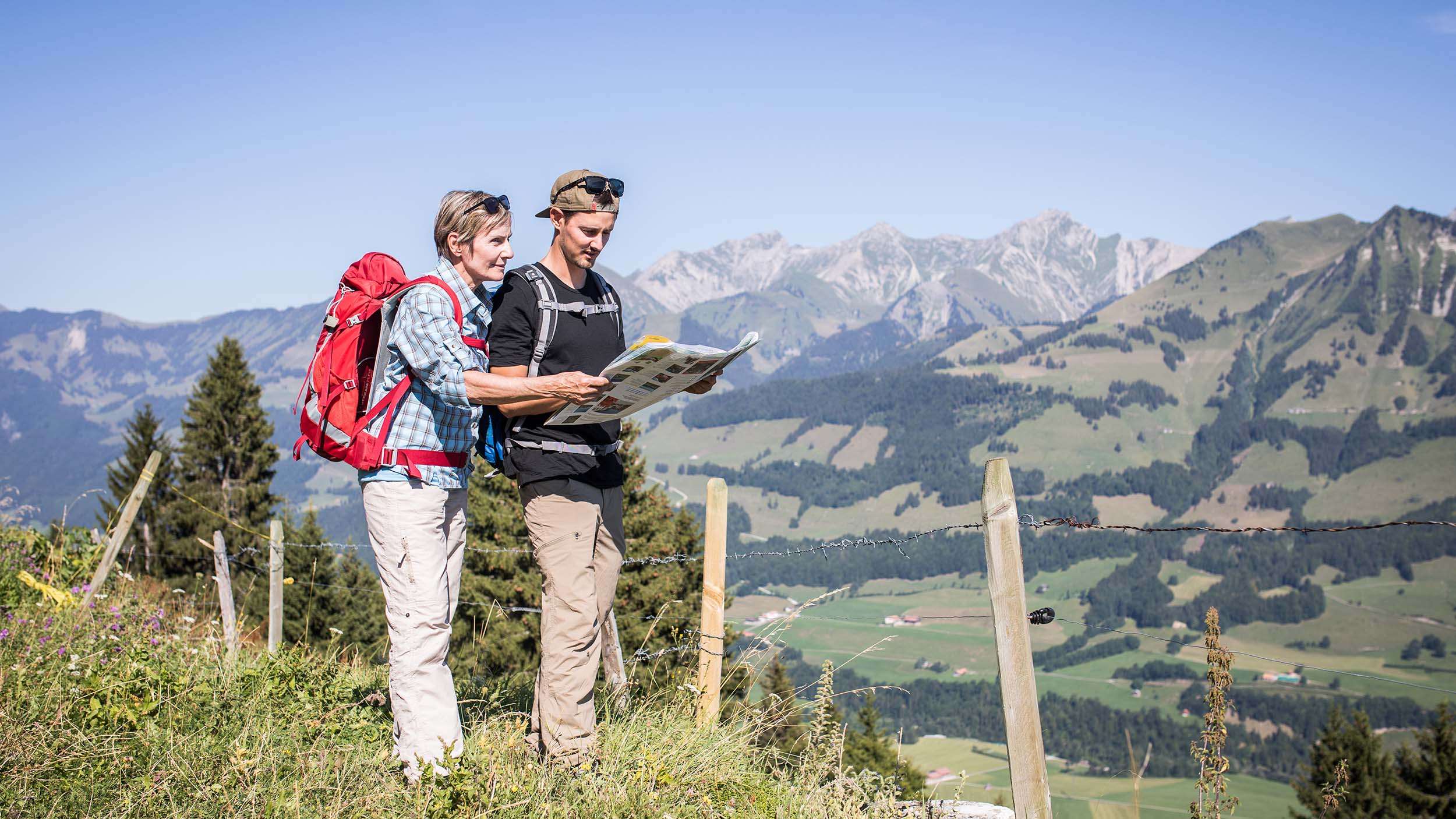
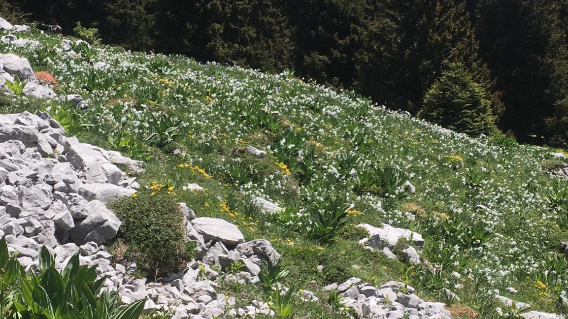
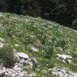
Above the village of Les Sciernes-d'Albeuve, this trail leads below the Dent de Lys to the En Lys mountain pasture. In spring, the wild narcissus flowers cover the meadows with a white carpet, similar to " snow in May ". A magical sight in respect of nature. Please stay on the marked trails and do not pick the flowers. This route is classified as a mountain hiking trail (red).
The trail starts at the Sciernes station (880 m) in the direction of Sciernes d'Amont. As soon as you leave the village, the itinerary is classified as a mountain hiking trail (red). Continue on the alpine road via Les Prés d'Albeuve to Teraula d'Avau (1309 m). This is where the trail really starts. The signposted path passes through Chenalette to reach the En Lys mountain pasture. In spring, this is a good spot for flowering narcissus. It is possible to go as far as the Chalet de Lys where water sometimes accumulates when the snow melts. The name given to the mountain pasture comes from the patois "li" which means "lake". Take the same trail to go back down. Before the village, it is possible to go through La Mytha to return to the starting point.
Variations:
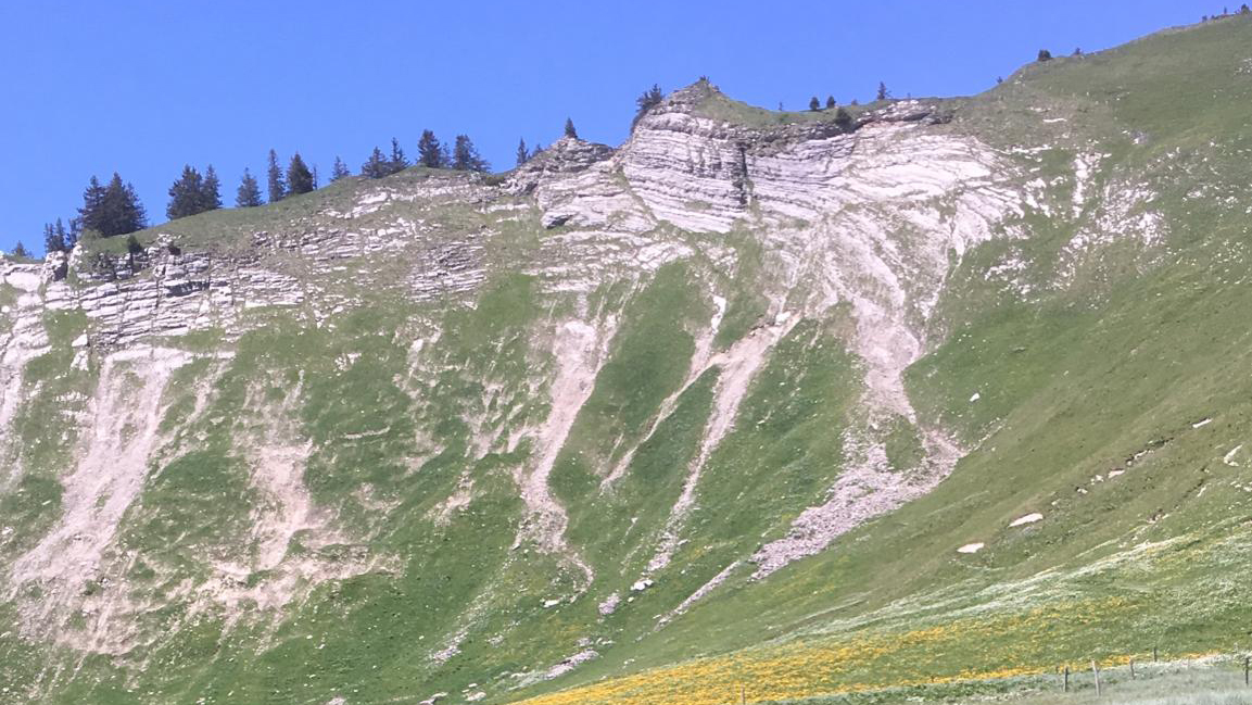
At the En Lys mountain pasture, it is possible to do a loop. Continue along the path which becomes rocky below the Folliu Borna, then to the Creux and back down along the marked trail to join the alpine road at Teraula d'Avau. Then follow the trail.
It is also possible to go to Les Paccots (4h30). After passing the marshes of En Lys, follow the path up to the Col de Lys. The panoramic view over the Alps to Lac Léman is worth a stop. Reach Les Paccots either via the small forest reserve Le Barlattey where you can admire yellow and purple gentians on the edge of the path, or via the shingle-covered mountain buvette called "La Saletta". The return to the valley is via alpine pastures and forest paths.
Please take your rubbish with you and do not leave any trace of your passage in the countryside.
Accessible via public transport: yes, every hour from Bulle with a change in Montbovon then MOB line (Montreux - Montbovon - Zweisimmen)
Accessible by car: yes, parking below Les Sciernes station
Information
La Gruyère Tourisme
Centre commercial Velâdzo (rez inférieur)
Place de la Gare 3
1630 Bulle

Properties of the itinerarie
Type of activity: Sports
Difficulty: Moderately difficult
Duration: 04:00
Distance: 12 km
Ascent/Descent: +749m / -750m
Altitude min./max.: 875m / 1605m
Itinerary type
- Scenic hike


