


This richly contrasting trail runs alongside the river Jogne, revealing a magnificent view over the impressive ridge of the Gastlosen chain.
SwitzerlandMobility: route 274
Oberbach (bei der Skistation Abländschenstrasse)
The route begins at the downhill station on the Gastlosenexpress of the cable car in the village of Jaun. The only German-speaking municipality in La Gruyère, the village perches 1,050 metres above sea level and as a result, is the highest location in Fribourg canton.
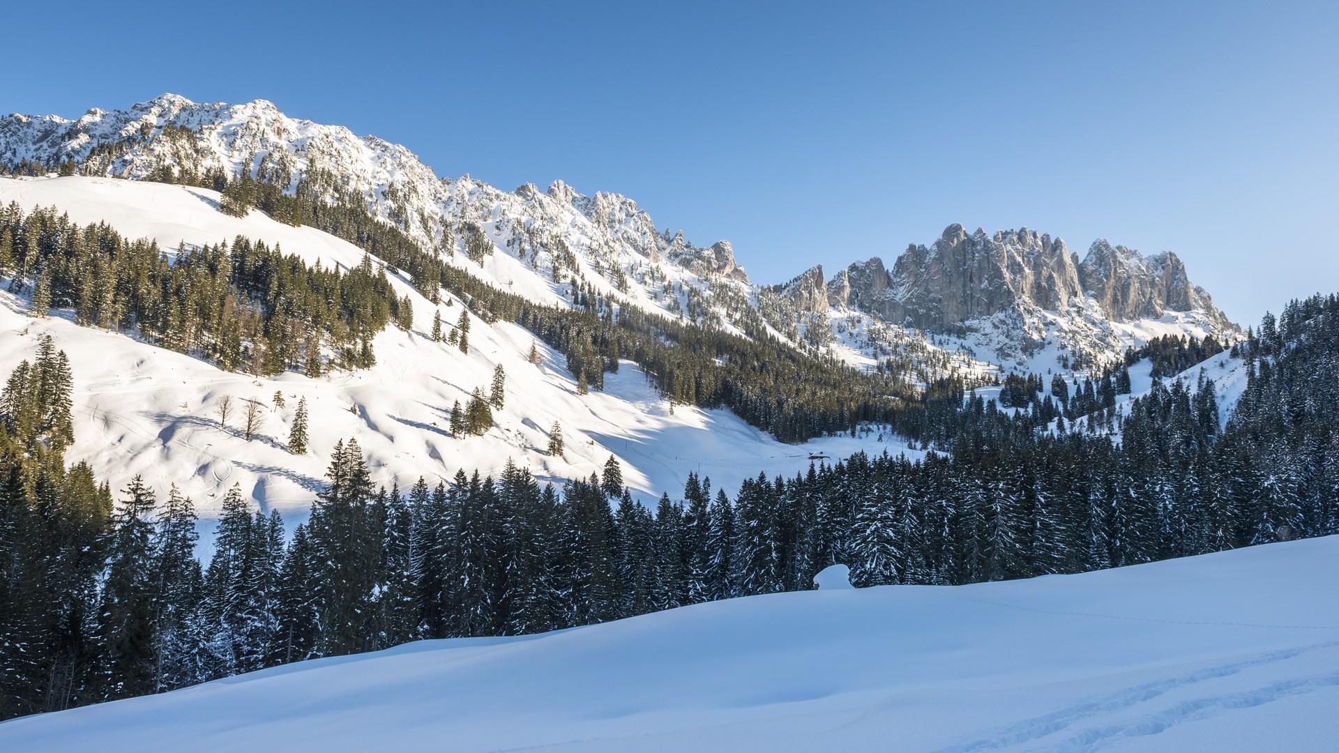
After crossing the bridge, the trail runs alongside the Jogne for a distance. It then climbs slowly to the Oberfang refuge before descending gently towards the Jogne. This stretch offers a magnificent view over the Gastlosen and the Bäderhore. The route then crosses the Abländschen street and follows the river to the right, climbing gently to the “gäge de Burpel”. It then descends to “Zelg” in a loop, and crosses the road and a meadow for around 200 metres. On the way back, the view opens up from the right flank of the Jogne valley to the summit of the Combifluh with its avalanche protection system. The Schopfenspitz is also visible, while the impressive limestone walls of the Gastlosen can again be seen on the left.
After crossing the road one more time, the trail continues to climb to the opposite mountain pasture, winding its way to the Jaunpassstrasse, the highest point on the route. It continues on the sunny side of the hill to the level of the ski tow in Oberbach and then descends alongside the ski run to the starting point.
Find in the "Download files" a complete description of the snowshoe trail to download, print and take with you during your hike.
Information
La Gruyère Tourisme
Centre commercial Velâdzo (rez inférieur)
Place de la Gare 3
1630 Bulle
This unprepared itinerary is marked. You take this trail at your own risk.
Properties of the itinerarie
Type of activity: Sports
Difficulty: Very easy
Duration: 01:35
Distance: 3 km
Ascent/Descent: +187m / -188m
Altitude min./max.: 1024m / 1127m


